VEKOM Geo
VEKOM Geo company from Belgrade, Serbia, founded in 1992. provides complete solutions for the collection, processing and presentation of geospatial data in the field of construction, geodesy, photogrammetry, LiDAR systems, machine control, 3D laser scanning, GIS and mapping. VEKOM Geo is owner of GNSS reference network and it offers reliable and quality services for precise satellite positioning on the territory of Serbia. Also, it owns service center for geodetic equipment authorized by Leica Geosystems and an accredited metrological laboratory for length, angle and volume.
Products:
- Leica Geosystems – GNSS receivers, total stations, aerial photogrammetric and LiDAR systems, 3D laser scanners, unmanned aerial systems, machine control systems, construction tools and detection of underground utilities;
- Hexagon Geospatial – software for collect, process, visualization, analyze, manage and deliver geospatial data in field of GIS, remote sensing and photogrammetry;
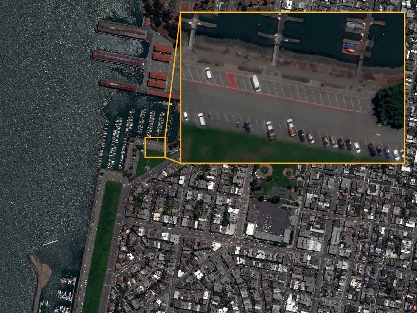
- European Space Imaging – high resolution satellite images;
- Planet – high resolution satellite images;
- Capella Space – high resolution radar satellite (SAR) images;
- Amberg Technologies – specialized measurement system for the railways and tunnels;
- WingtraOne – unmanned aerial systems.
Standards and certifications:
ISO 9001:2015 – Quality management system, Certificates of IQNet and YUQS (ISO 9001:2015);
ISO/IEC 17025:2017 – Laboratory management system, Accreditation Certificate of the Accreditation Body of Serbia (ISO/IEC 17025:2017).
VEKOM
A: Todora Dukina 61, 11000 Belgrade, Serbia
P: + 381 11 28 50 655
M: + 381 63 63 87 87
E: office@vekom.com
www.vekom.com